
By Marilyn Jones
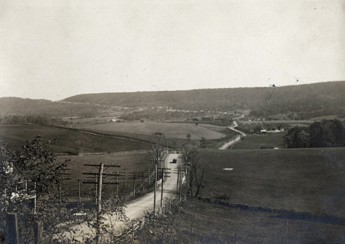
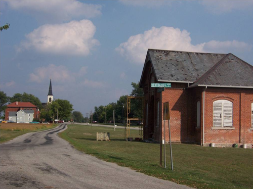
Rambling along U.S. Highway 30 in Central Ohio, past farms and through small communities, it’s hard to believe this stretch of highway was once part of a heated debate about where the Lincoln Highway—America’s first transcontinental roadway—would be routed. It’s also interesting to learn about the history of the modern highway system and the Lincoln Highway’s part in connecting this nation coast to coast.
According to Cincinnati author and Lincoln Highway Association member Denny Gibson, most of the 2.5 million miles of roads in the 1900s were “of the farm-to-market sort that allowed a farmer to get his crops to the nearest town or a railroad connection but no farther. And there was very little paving so rain or snow could frequently make even the road to town impassable. Long distance travel was handled by rail.”
Enter Carl Fisher, an Indianapolis businessman who made a lot of money from automobiles. He was quite the promoter and idea man and one of the founders of the Indianapolis Motor Speedway.
“Carl realized that, in order for the automotive industry to continue to grow, owners needed somewhere to drive their machines besides race tracks and city streets,” Gibson says. “He proposed a ‘Coast-to-Coast Rock Highway.’”
A colleague, Henry Joy, president of the Packard Motor Car Company, suggested the name Lincoln Highway and before long the Lincoln Highway
Association was formed by Fisher and others to promote and build the highway.
The plan called for a graveled road that would cost about $10 million. To fund it, Fischer asked for cash donations from auto manufacturers and accessory companies of 1 percent of their revenues. Henry Ford believed the public would never learn to fund good roads if private industry did it for them; he did not support the idea. But the country had become so enthusiastic about the highway, Fisher wouldn’t give up.
The route was announced in the fall of 1913; pieced together from existing roads where possible. Joy, now also president of the Lincoln Highway Association, presented the route before the Conference of Governors.
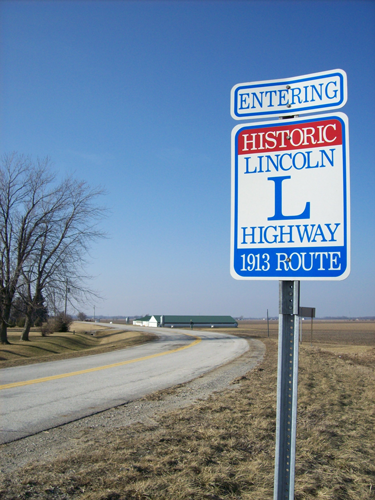
The highway, officially 3,389 miles long, was mapped to begin in New York City, pass through New Jersey, Pennsylvania, Ohio, Indiana, Illinois, Iowa, Nebraska, Wyoming, Utah, Nevada, and California, ending in San Francisco.
“Of course everyone wanted to be on the highway,” says Gibson smiling. “And they weren’t happy when they were left off.”
When fundraising stalled, Joy decided to abandon the fund and redirect the association toward educating the country to the need for good roads made of concrete with an improved Lincoln Highway as an example. The federal government passed the Federal Highway Acts of 1916 and 1921 providing matching funds to the states for highway construction greatly benefiting the Lincoln Highway.
Other named highways were built between 1915 and 1925 as well, turning national highways into an unorganized and confusing system; many only marked by painted color-bands on telephone poles.
In March 1925, the American Association of State Highway Officials (AASHO) started planning a federal highway system. All named roads were ignored in their planning. A revised plan approved in November 1926 divided the Lincoln Highway among several numbers
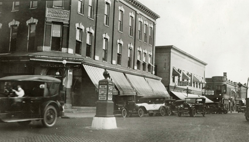
The AASHO also adopted a standard set of road signs and markers. All highway names were taken down. As a way around this, the association enlisted the help of thousands of Boy Scouts. They fanned out along the highway in 1928 to install small busts of Lincoln with the inscription: ‘This highway dedicated to Abraham Lincoln.’
“The original Lincoln Highway Association disbanded in the 1930s,” says Gibson. “The current association was formed in 1992 to identify and
preserve the route and promote awareness of it. I’ve been a member since 2000.
“I’ve driven all of the Lincoln Highway at least twice,” he says. “I like old roads, not just the Lincoln Highway. Driving the old roads lets you slow down and see some history; sometimes even experience a little of it.”
For more information:
To read about Gibson’s travels, check his website at dennygibson.com.
To learn about the Lincoln Highway Association and find links to specific state chapters go to lincolnhighwayassoc.org.